
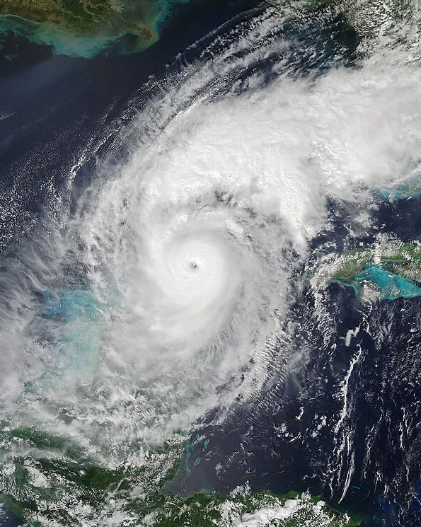
Hurricane Milton has ripped through Florida recently, leaving a trail of destruction behind it. Why is it that this storm has had scientists spooked?
In the span of 48 hours, what started as a tropical storm turned into a Category 5 Hurricane. This rapid intensification paired with exceptionally high wind speeds, exceeding over 175mph (approximately 280 km/h), which is extremely unusual for an October hurricane, has raised concerns among the scientific community. The term Rapid “intensification” is used when maximum sustained wind speeds increase by at least 30 knots (approximately 35mph) within a 24-hour period. BBC analysed data, provided by the US National Hurricane Center, and found that “Hurricane Milton strengthened by more than 90mph in 24 hours”.This drastic increase in speed can account for the storm moving up several categories in the Saffir-Simpson Scale.
Hurricane Milton didn’t start as a particularly large storm, this meant it could maintain its tight, high speed rotation, circling its narrow eye. Within the eye of the hurricane, the pressure dropped by 50mb in the span of 10 hours, this severe change in pressure had one meteorologist, John Morales, calling the storm “horrific”. This notable pressure drop is important as lower central pressures allow for the storm to be stronger with higher maximum sustained wind speeds.
As Hurricane Milton crossed the Gulf of Mexico, it encountered record high ocean temperatures, which stretched deep below the surface. This fueled the hurricane, providing it the energy it needed to climb the Saffir-Simpson Scale with such rapid intensification. Hurricane Milton was actually the strongest hurricane in the Gulf of Mexico since Hurricane Rita in 2005.
As the average Global Temperature has been consistently rising in recent years, it is providing the ideal environment for the formation of powerful hurricanes. A New York Times article states that “Tropical storms in the Gulf of Mexico are 50% more likely to undergo rapid intensification during... periods of hot sea surface temperatures”, so we can expect to see more stories like this, across the rest of the Atlantic hurricane season this year.